
Tierra Data provides expertise in the environmental regulatory process and documentation requirements. Clients request assistance in screening environmental compliance strategies and environmentally preferred project sites and designs. We guide the design of conservation and mitigation banking agreements, mitigation monitoring and reporting, including biological monitoring of construction projects to ensure compliance with a project's permit conditions and success criteria.
Services
– Wetland delineation
– Wetland permitting, Arid West Regional Supplement
– Mitigation strategies
– State of California CDFG 1600 Streambed Alteration
– Streambed Rapid Bioassessment, CDFG trained team
Certification & Registrations
– U.S. Army Corps of Engineers 1987 Manual certified
– Riparian Registered CRAM Team
– Estuarine Registered CRAM Team
Tierra Data Enables Sound Sustainable Use Decisions
We conduct jurisdictional delineation of wetlands to support development permits, Integrated Natural Resources Management Plans and related conservation of natural resources projects. We help land managers plan avoidance and minimization measures.
KEY PROJECT
Wetland Delineation and Aquatic Habitat Inventory at Detachment Concord
To support the assessment of impact, permit processing and mitigation planning, Tierra Data delineated all jurisdictional and non-jurisdictional wetland and non-wetland waters of the U.S. on the Inland Area, a 5,204-acre property at Detachment Concord. In addition, a broad range of vernal pools and all aquatic habitat including seasonal pools were mapped, with incidental observation of rare plants and wildlife.
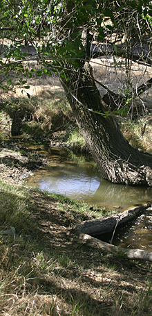
Illustration © Terry Lockman
Photo © Tierra Data Inc.