
San Diego Bay-wide Avian Surveys
We are now in the third iteration of surveys to census water-dependent birds in San Diego Bay. Surveys are tidally and seasonally indexed to detect the most use possible of shoreline and bay waters. Repeating these surveys every three to five years will allow detection of a significant change in the key population using the San Diego Bay and assists in the protection and adaptive management of the Bay and its species. The work is jointly funded by the Port of San Diego, the U.S. Navy, and the USFWS Refuges.
Services
– Wetland Delineation, Rapid Assessment and Mitigation Planning
– Vegetation Mapping & General Wildlife Surveys
– Special Status Species Surveys
– Long-term Ecological Monitoring
Permits & Certifications
Federal Fish and Wildlife Endangered Species Section 10(a)(1)(A) permits for various species
California Rapid Assessment Method (CRAM) riverine wetlands, estuarine wetlands, and vernal pool systems
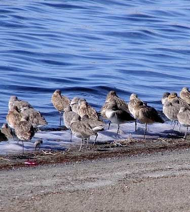
Photo © John Lovio
KEY PROJECT