We have exceptional experience designing and implementing long-term programs using quantitative measures for vegetation condition and trend, soil quality, water quality, management focus species, and ecological process indicators.
Services
– Land condition and trend assessment
– Ecological Site Assessment
– National Rangeland Inventory
– Kelp forest monitoring programs
– Intertidal long-term monitoring projects
– Avian monitoring programs
– Soil erosion
– Vegetation condition
– Fire recovery
– Invasive species trend modeling
Training
International vegetation classification standards using the VegCAMP (CDFG/California Native Plant Society training)
Excellent Data Analysis Enables Enduring Solutions
We statistically analyze data acquired from the field and interpret it for managers and decision-makers. We recommend sampling designs that are cost-effective and efficient at getting to the key, early-warning indicators of ecological change.
KEY PROJECT
San Clemente Island Vegetation Condition and Trend Analysis
In 1993, Tierra Data, under contract with the U.S. Navy, implemented a long-term vegetation monitoring program for San Clemente Island. We documented dynamic changes taking place in the biotic and abiotic environment following the removal of feral goats. We established and monitored more than 100 vegetation plots on San Clemente Island, sampling intermittently for close to 20 years. A variety of vegetation parameters were collected and analyzed. This trend analysis aids in conserving a full range of natural habitat diversity and species, native to this biologically distinctive island, within context of the military mission.
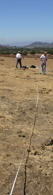
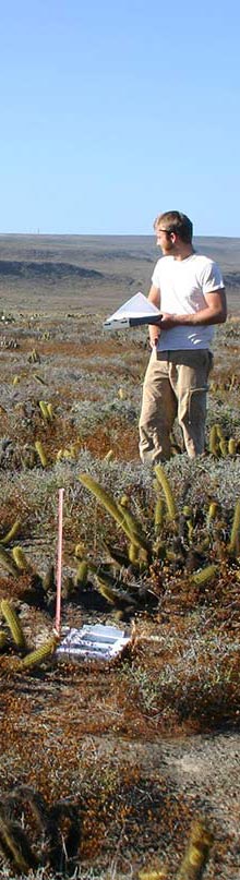
Illustration © Christine Elder
Photo © Tierra Data